Geolocate

Mount Wright topographic map

Click on the map to display elevation.

About this map
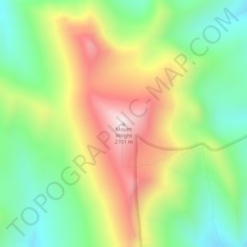
Name: Mount Wright topographic map, elevation, terrain.

Location: Mount Wright, Teton County, Montana, United States (47.97796 -112.84788 47.97806 -112.84778)

Average elevation: 2,256 m

Minimum elevation: 1,935 m

Maximum elevation: 2,703 m

Other topographic maps

Click on a map to view its topography, its elevation and its terrain.
Gibson Reservoir

United States > Montana > Teton County

Average elevation: 1,645 m

Choteau

United States > Montana > Teton County

Average elevation: 1,173 m

Gear up for your next adventure:

🪑Portable Backpacking Chairs - A comfortable seat for studying maps at the end of the day
🩹Wilderness First Aid Kits - Comprehensive medical kits tailored for hiking and remote exploration
🧤Hiking Gloves - Protective gloves for outdoor use
🔑Heavy Duty Carabiners - Secure gear to the outside of your pack for easy access
🦟Heavy Duty Insect Repellent - Essential protection against flies, mozzies, and march flies

As an Amazon Associate, this site earns from qualifying purchases at no extra cost to you.