
Stafford topographic map
Interactive map
Click on the map to display elevation.
About this map
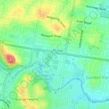
Name: Stafford topographic map, elevation, terrain.
Location: Stafford, Brisbane City, Queensland, Australia (-27.41953 152.99756 -27.40160 153.02496)
Average elevation: 40 m
Minimum elevation: 13 m
Maximum elevation: 91 m
Queensland trails, hiking, mountain biking, running and outdoor activities
Other topographic maps
Click on a map to view its topography, its elevation and its terrain.