
Bloomfield topographic map
Interactive map
Click on the map to display elevation.
About this map
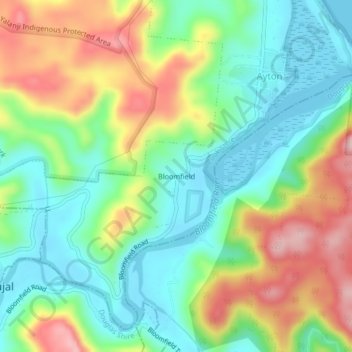
Name: Bloomfield topographic map, elevation, terrain.
Location: Bloomfield, Queensland, Australia (-15.95333 145.32166 -15.91333 145.36166)
Average elevation: 81 m
Minimum elevation: -1 m
Maximum elevation: 216 m
Queensland trails, hiking, mountain biking, running and outdoor activities
Other topographic maps
Click on a map to view its topography, its elevation and its terrain.