
I. kerület topographic map
Interactive map
Click on the map to display elevation.
About this map
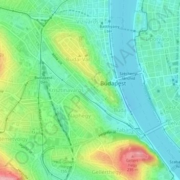
Name: I. kerület topographic map, elevation, terrain.
Location: I. kerület, Boedapest, Centraal-Hongarije, Hongarije (47.48567 19.02376 47.50807 19.05131)
Average elevation: 137 m
Minimum elevation: 97 m
Maximum elevation: 228 m
Other topographic maps
Click on a map to view its topography, its elevation and its terrain.
V. kerület
V. kerület, Boedapest, Centraal-Hongarije, Hongarije
Average elevation: 122 m
X. kerület
X. kerület, Boedapest, Centraal-Hongarije, Hongarije
Average elevation: 129 m
Hűvösvölgy
Hűvösvölgy, 2. kerület, Boedapest, Közép-Magyarország, Hongarije
Average elevation: 274 m