
中園町 topographic map
Interactive map
Click on the map to display elevation.
About this map
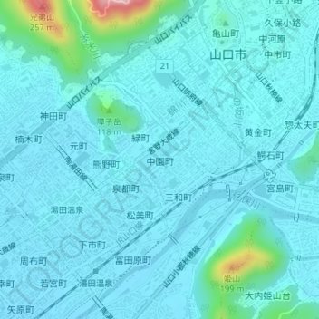
Name: 中園町 topographic map, elevation, terrain.
Location: 中園町, Yamaguchi, Prefectura de Yamaguchi, 753-0075, Japón (34.16686 131.46400 34.17129 131.46986)
Average elevation: 38 m
Minimum elevation: 12 m
Maximum elevation: 245 m
Other topographic maps
Click on a map to view its topography, its elevation and its terrain.