
勝井 topographic map
Interactive map
Click on the map to display elevation.
About this map
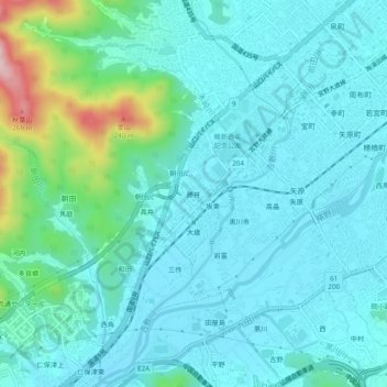
Name: 勝井 topographic map, elevation, terrain.
Location: 勝井, Yamaguchi, Prefectura de Yamaguchi, 753-0851, Japón (34.13027 131.41293 34.17027 131.45293)
Average elevation: 47 m
Minimum elevation: 1 m
Maximum elevation: 274 m
Other topographic maps
Click on a map to view its topography, its elevation and its terrain.