
Wartet topographic map
Interactive map
Click on the map to display elevation.
About this map
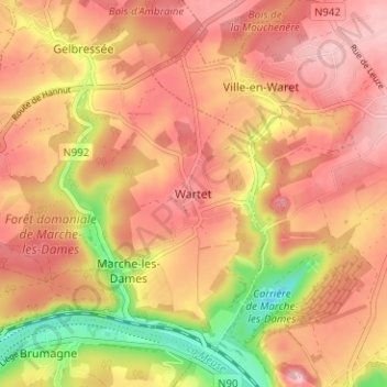
Name: Wartet topographic map, elevation, terrain.
Location: Wartet, Namur, Wallonie, 5024, Belgique (50.47442 4.95206 50.51442 4.99206)
Average elevation: 161 m
Minimum elevation: 56 m
Maximum elevation: 218 m
Other topographic maps
Click on a map to view its topography, its elevation and its terrain.