
Suarlée topographic map
Interactive map
Click on the map to display elevation.
About this map
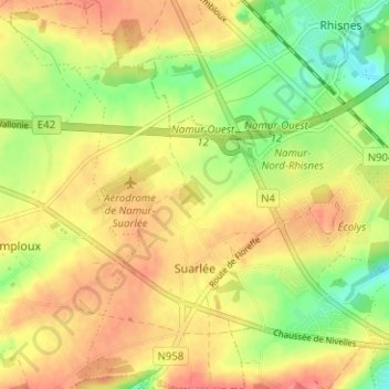
Name: Suarlée topographic map, elevation, terrain.
Location: Suarlée, Namur, Wallonie, 5020, Belgique (50.46826 4.75040 50.50824 4.81271)
Average elevation: 168 m
Minimum elevation: 133 m
Maximum elevation: 195 m
Other topographic maps
Click on a map to view its topography, its elevation and its terrain.