
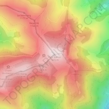
Petit Ballon topographic map
Interactive map
Click on the map to display elevation.
About this map
Name: Petit Ballon topographic map, elevation, terrain.
Average elevation: 1,050 m
Minimum elevation: 676 m
Maximum elevation: 1,266 m
Le Petit Ballon (Kahler Wasen ou Kleiner Belchen en allemand) est un sommet secondaire du massif des Vosges situé dans le département du Haut-Rhin (Grand Est). Il culmine à 1 272 mètres d'altitude. Son sommet donne un point de vue panoramique, marqué par une statue de la Vierge et une antenne-relais radio. La route ne permet pas d'accéder directement au sommet mais seulement au col à 1 163 m d'altitude.
Other topographic maps
Click on a map to view its topography, its elevation and its terrain.
Gustermatt
France > Grand Est > Haut-Rhin > Linthal
Gustermatt, Linthal, Thann-Guebwiller, Haut-Rhin, Grand Est, France métropolitaine, 68610, France
Average elevation: 1,052 m