Geolocate

Gustermatt topographic map

Interactive map

Click on the map to display elevation.

About this map

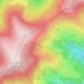
Name: Gustermatt topographic map, elevation, terrain.

Location: Gustermatt, Linthal, Thann-Guebwiller, Haut-Rhin, Grand Est, France métropolitaine, 68610, France (47.95224 7.08368 47.97224 7.10368)

Average elevation: 1,052 m

Minimum elevation: 659 m

Maximum elevation: 1,281 m

Other topographic maps

Click on a map to view its topography, its elevation and its terrain.

Petit Ballon

France > Grand Est > Haut-Rhin > Linthal

Petit Ballon, Linthal, Thann-Guebwiller, Haut-Rhin, Grand Est, France métropolitaine, 68610, France

Average elevation: 1,050 m

Hilsen

France > Grand Est > Haut-Rhin > Linthal

Hilsen, Linthal, Thann-Guebwiller, Haut-Rhin, Grand Est, France métropolitaine, 68610, France

Average elevation: 940 m

Rimbuhl

France > Grand Est > Haut-Rhin > Linthal

Rimbuhl, Linthal, Thann-Guebwiller, Haut-Rhin, Grand Est, France métropolitaine, 68610, France

Average elevation: 911 m