
Gemeinde Pottendorf topographic map
Interactive map
Click on the map to display elevation.
About this map
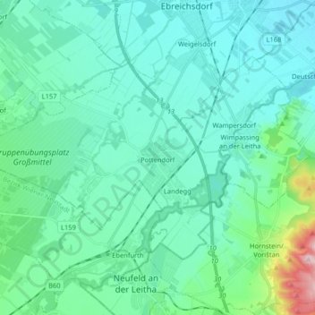
Name: Gemeinde Pottendorf topographic map, elevation, terrain.
Average elevation: 229 m
Minimum elevation: 191 m
Maximum elevation: 437 m
Other topographic maps
Click on a map to view its topography, its elevation and its terrain.
Gemeinde Bad Vöslau
Austria > Lower Austria > Bezirk Baden > Gemeinde Bad Vöslau
Gemeinde Bad Vöslau, Bezirk Baden, Lower Austria, Austria
Average elevation: 313 m