
Cadaval topographic map
Interactive map
Click on the map to display elevation.
About this map
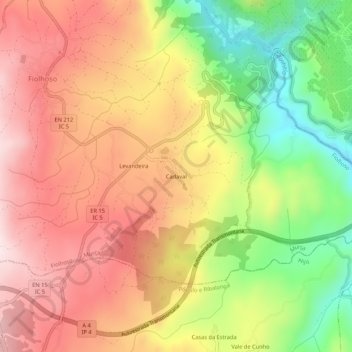
Name: Cadaval topographic map, elevation, terrain.
Location: Cadaval, Fiolhoso, Murça, Vila Real, 5090-051, Portugal (41.37558 -7.50313 41.41558 -7.46313)
Average elevation: 611 m
Minimum elevation: 372 m
Maximum elevation: 801 m
Other topographic maps
Click on a map to view its topography, its elevation and its terrain.