
Fiolhoso topographic map
Interactive map
Click on the map to display elevation.
About this map
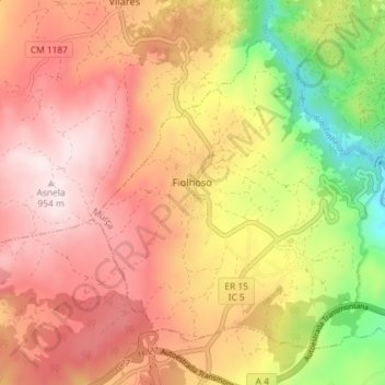
Name: Fiolhoso topographic map, elevation, terrain.
Location: Fiolhoso, Murça, Vila Real, Portugal (41.38330 -7.52213 41.42711 -7.44986)
Average elevation: 712 m
Minimum elevation: 384 m
Maximum elevation: 943 m
Other topographic maps
Click on a map to view its topography, its elevation and its terrain.