
Cabrois topographic map
Interactive map
Click on the map to display elevation.
About this map
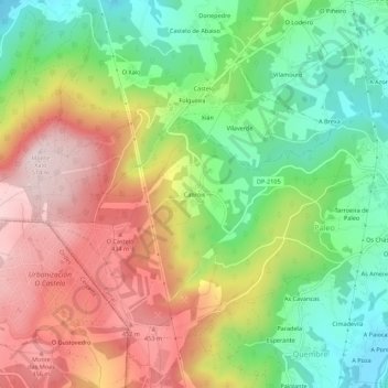
Name: Cabrois topographic map, elevation, terrain.
Location: Cabrois, Paleo, Carral, La Coruña, Galicia, 15175, España (43.20803 -8.40664 43.24803 -8.36664)
Average elevation: 274 m
Minimum elevation: 73 m
Maximum elevation: 510 m
Other topographic maps
Click on a map to view its topography, its elevation and its terrain.