
Claude Road topographic map
Interactive map
Click on the map to display elevation.
About this map
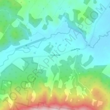
Name: Claude Road topographic map, elevation, terrain.
Location: Claude Road, Tasmania, Australia (-41.45390 146.25613 -41.41390 146.29613)
Average elevation: 312 m
Minimum elevation: 183 m
Maximum elevation: 668 m
Other topographic maps
Click on a map to view its topography, its elevation and its terrain.
Mount Roland Conservation Area
Australia > Tasmania > Claude Road
Mount Roland Conservation Area, Mount Roland via Kings Road (Face Track), Claude Road, Tasmania, Australia
Average elevation: 731 m