
Ciorani topographic map
Interactive map
Click on the map to display elevation.
About this map
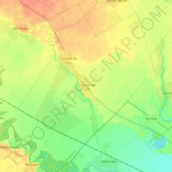
Name: Ciorani topographic map, elevation, terrain.
Location: Ciorani, Prahova, Romania (44.76105 26.34475 44.88156 26.50931)
Average elevation: 75 m
Minimum elevation: 57 m
Maximum elevation: 91 m
Other topographic maps
Click on a map to view its topography, its elevation and its terrain.
Valea Mantei
Romania > Prahova > Valea Mantei
Valea Mantei, Valea Călugărească, Prahova, 107631, Romania
Average elevation: 230 m
Valea Călugărească
Romania > Prahova > Valea Călugărească
Valea Călugărească, Prahova, Romania
Average elevation: 154 m