Geolocate

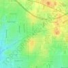
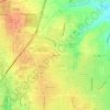
Princeton topographic map

Click on the map to display elevation.

About this map

Name: Princeton topographic map, elevation, terrain.

Location: Princeton, Collin County, Texas, United States (33.10179 -96.54284 33.24332 -96.43192)

Average elevation: 168 m

Minimum elevation: 146 m

Maximum elevation: 206 m

Other topographic maps

Click on a map to view its topography, its elevation and its terrain.

Princeton

United States > Texas > Collin County

Average elevation: 172 m

Renner

United States > Texas > Collin County > Dallas

Average elevation: 206 m

Clear Lake

United States > Texas > Collin County

Average elevation: 157 m

Culleoka

United States > Texas > Collin County

Average elevation: 163 m

Desert

United States > Texas > Collin County

Average elevation: 206 m

Lavon

United States > Texas > Collin County

Average elevation: 156 m

Russell Creek Park

United States > Texas > Collin County > Plano

Average elevation: 227 m

Renner

United States > Texas > Collin County > Dallas

Average elevation: 206 m

Frisco

United States > Texas > Collin County > Frisco

When the Dallas area was being settled by American pioneers, many of the settlers traveled by wagon trains along the Shawnee Trail. This trail became the Preston Trail, and later, Preston Road. With all of this activity, the community of Lebanon was founded along this trail, and was granted a U.S. post office…

Average elevation: 191 m

Weston

United States > Texas > Collin County

Average elevation: 218 m

Lavon

United States > Texas > Collin County

Average elevation: 156 m

Plano

United States > Texas > Collin County > Plano

At first, Plano's population grew slowly, reaching 1,304 in 1900 and 3,695 in 1960. By 1970, Plano began to feel some of the boom its neighbors had experienced after World War II. A series of public works projects and a change in taxes that removed the farming community from the town helped increase the…

Average elevation: 181 m

Altoga

United States > Texas > Collin County

Average elevation: 176 m

Wetsel

United States > Texas > Collin County > Allen

Average elevation: 200 m

Princeton

United States > Texas > Collin County

Average elevation: 172 m

Desert

United States > Texas > Collin County

Average elevation: 206 m

Gear up for your next adventure:

🩹Blister Prevention Tape - Apply to friction points before they become painful sores
🚁Camera Drones with GPS - Capture aerial views of the landscape to compare with topo maps
🖼️Scratch-off Australia Map - Track the regions and peaks you have explored geographically
📷Backpack Camera Clips - Quick access to your camera while keeping your hands free for climbing
🔥Ferrocerium Rod Fire Starters - Reliable fire lighting in wet or windy conditions without matches

As an Amazon Associate, this site earns from qualifying purchases at no extra cost to you.