Geolocate

Oronoco topographic map

Click on the map to display elevation.

About this map

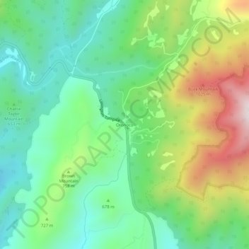
Name: Oronoco topographic map, elevation, terrain.

Location: Oronoco, Amherst County, Virginia, United States (37.71736 -79.27364 37.75736 -79.23364)

Average elevation: 689 m

Minimum elevation: 440 m

Maximum elevation: 1,175 m

Gear up for your next adventure:

🍳Ultralight Camping Stoves - Boil water quickly for meals using minimal fuel
🚴Cycling Backpacks - Backpacks for cyclists
📱Shockproof Phone Cases - Extra protection for your smartphone against drops on rocky terrain
🔭Compact Hiking Binoculars - Lightweight optics for scouting routes or birdwatching
🏫Topographic World Globes - 3D physical relief globes to understand global geography

As an Amazon Associate, this site earns from qualifying purchases at no extra cost to you.