

Virginia topographic maps
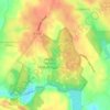
Click on a map to view its topography, its elevation and its terrain.

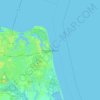
Virginia Beach
United States > Virginia > Virginia Beach
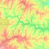
Virginia Beach, Virginia, located in the coastal region of the United States, features a predominantly flat terrain characterized by its proximity to the Atlantic Ocean. The elevation is remarkably low, averaging about 10 feet (3 meters) above sea level, which contributes to the area's susceptibility to…
Average elevation: 2 m









































About this place
Frederick County • Albemarle County • Fairfax County • Virginia Beach • Fauquier County • Fluvanna County • Loudoun County • Cumberland County • Augusta County • Chesterfield County • Culpeper County • Montgomery County • Chesapeake • Accomack County • Henry County • Prince William County • Bedford County • Nelson County • Hampton • Pittsylvania County • Rockingham County • Botetourt County • Shenandoah County • Buchanan County • Tazewell County • Henrico County • Goochland County • Richmond • Norfolk • Middlesex County • Mathews County • Warren County • Northampton County • Rockbridge County • Mecklenburg County • Pulaski County • King George County • Franklin County • James City County • Scott County • Page County • Roanoke County • Caroline County • Wythe County • Madison County • Bath County • Hanover County • Dickenson County • Spotsylvania County • Amherst County • Suffolk (city) • Clarke County • Brunswick County • Rappahannock County • Campbell County • Patrick County • Washington County • Russell County • Greene County • Lancaster County • King and Queen County • Carroll County • Buckingham County • Halifax County • Giles County • Isle of Wight County • Alleghany County • Arlington County • Powhatan County • Richmond County • Northumberland County • Floyd County • Gloucester County • Prince Edward County • Prince George County • Highland County • Dinwiddie County • York County • Surry County • Stafford County • Orange County • Bristol • Appomattox County • Smyth County • Suffolk • Essex County • Wise County • Southampton County • Amelia County • Lee County • King William County • Bland County • Westmoreland County • Louisa County • Danville • Charlotte County • Poquoson • Radford (city) • Virginia Beach (city) • Danville