Geolocate

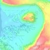
Delicate Arch topographic map

Click on the map to display elevation.

Delicate Arch

Delicate Arch is one of the main tourist draws in Arches National Park. The parking lot at the Delicate Arch Trailhead, although large, fills up quickly on most days. The trail to Delicate Arch is 3 miles (4.8 kilometer) round trip with an elevation change of 480 feet (146 meters). The trail is well defined for the first 1/2 mile, then does a steep incline over open rock. There is a narrow ledge for the last 200 yards (183 meter) before reaching the arch.

Wikipedia (CC-BY-SA 3.0)

About this map

Name: Delicate Arch topographic map, elevation, terrain.

Location: Delicate Arch, Grand County, Utah, United States (38.74341 -109.49945 38.74353 -109.49913)

Average elevation: 1,409 m

Minimum elevation: 1,309 m

Maximum elevation: 1,490 m

Other topographic maps

Click on a map to view its topography, its elevation and its terrain.

Taylor Flat

United States > Utah > Grand County

Average elevation: 2,580 m

Jackson Hole

United States > Utah > Grand County

Average elevation: 1,313 m

Castleton Tower

United States > Utah > Grand County

Average elevation: 1,549 m

Manns Peak

United States > Utah > Grand County

Average elevation: 3,427 m

Westwater

United States > Utah > Grand County

Average elevation: 1,349 m

Tenmile Point

United States > Utah > Grand County

Average elevation: 1,347 m

Gear up for your next adventure:

🛌Compact Down Sleeping Bags - Warmth without the bulk, ideal for backcountry camping
🛠️Outdoor Repair Kits - Gear repair kits
🩹Blister Prevention Tape - Apply to friction points before they become painful sores
📡Portable Emergency Radios - Stay informed about weather warnings and bushfire alerts
🧥Insulated Down Jackets - High warmth-to-weight ratio for cold nights in the high country

As an Amazon Associate, this site earns from qualifying purchases at no extra cost to you.