
Princeton topographic map
Interactive map
Click on the map to display elevation.
About this map
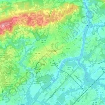
Name: Princeton topographic map, elevation, terrain.
Location: Princeton, Mercer County, New Jersey, United States (40.30489 -74.72212 40.39173 -74.61751)
Average elevation: 45 m
Minimum elevation: 13 m
Maximum elevation: 130 m
Other topographic maps
Click on a map to view its topography, its elevation and its terrain.
Hopewell Township
United States > New Jersey > Mercer County
Hopewell Township, Mercer County, New Jersey, 08560, United States
Average elevation: 72 m