Geolocate

Yuktali topographic map

Click on the map to display elevation.

About this map
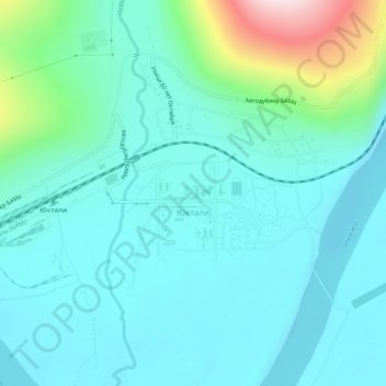
Name: Yuktali topographic map, elevation, terrain.

Location: Yuktali, Тындинский муниципальный округ, Amur Oblast, Far Eastern Federal District, 676268, Russia (56.58340 121.61691 56.60715 121.66738)

Average elevation: 462 m

Minimum elevation: 391 m

Maximum elevation: 772 m

Other topographic maps

Click on a map to view its topography, its elevation and its terrain.

Gear up for your next adventure:

🏕️Camping Gear - Essential camping equipment
🔪Multitools - Compact tools for outdoor use
🎨Portable Watercolor Kits - Paint the landscapes and topographic views you discover
🧥Packable Rain Jackets - Breathable waterproof layers for unpredictable mountain weather
📣High-Decibel Survival Whistles - Signaling tool for rescue that carries much further than a human voice

As an Amazon Associate, this site earns from qualifying purchases at no extra cost to you.