Geolocate

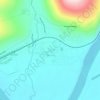
Stanovoy Range topographic map

Click on the map to display elevation.

About this map

Name: Stanovoy Range topographic map, elevation, terrain.

Location: Stanovoy Range, Тындинский муниципальный округ, Amur Oblast, Far Eastern Federal District, Russia (55.53255 125.92375 55.53265 125.92385)

Average elevation: 1,141 m

Minimum elevation: 901 m

Maximum elevation: 1,527 m

Other topographic maps

Click on a map to view its topography, its elevation and its terrain.
Gear up for your next adventure:

🌿Flora and Fauna Field Guides - Identify the plants and animals you encounter on your route
🥾Heavy Duty Hiking Boots - Ankle-supporting boots for carrying heavy packs on steep contours
🏫Topographic World Globes - 3D physical relief globes to understand global geography
🔌Fast Charging Adapters - Quickly top up all your gear before heading back into the field
🧴SPF 50+ Bulk Sunscreen - Maximum protection for long-term outdoor exposure

As an Amazon Associate, this site earns from qualifying purchases at no extra cost to you.