
Mayfield Township topographic map
Interactive map
Click on the map to display elevation.
About this map
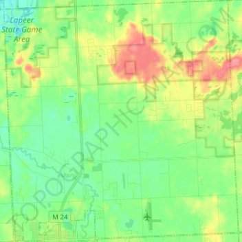
Name: Mayfield Township topographic map, elevation, terrain.
Location: Mayfield Township, Lapeer County, Michigan, United States (43.05742 -83.34821 43.14867 -83.22669)
Average elevation: 258 m
Minimum elevation: 233 m
Maximum elevation: 303 m
Other topographic maps
Click on a map to view its topography, its elevation and its terrain.
Burnside Township
United States > Michigan > Lapeer County
Burnside Township, Lapeer County, Michigan, United States
Average elevation: 257 m