
Burnside Township topographic map
Interactive map
Click on the map to display elevation.
About this map
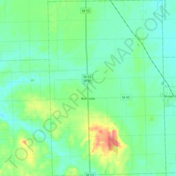
Name: Burnside Township topographic map, elevation, terrain.
Location: Burnside Township, Lapeer County, Michigan, United States (43.15196 -83.11903 43.28493 -82.99618)
Average elevation: 257 m
Minimum elevation: 238 m
Maximum elevation: 321 m
Other topographic maps
Click on a map to view its topography, its elevation and its terrain.
Mayfield Township
United States > Michigan > Lapeer County
Mayfield Township, Lapeer County, Michigan, United States
Average elevation: 258 m