
Naka topographic map
Click on the map to display elevation.
About this map
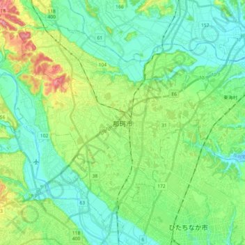
Name: Naka topographic map, elevation, terrain.
Location: Naka, Ibaraki Prefecture, Japan (36.39908 140.38681 36.51578 140.56628)
Average elevation: 28 m
Minimum elevation: -2 m
Maximum elevation: 98 m
Other topographic maps
Click on a map to view its topography, its elevation and its terrain.