Geolocate

Springfield topographic map

Click on the map to display elevation.

About this map
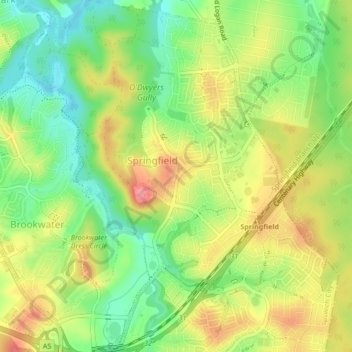
Name: Springfield topographic map, elevation, terrain.

Location: Springfield, Ipswich, Brisbane, Queensland, Australia (-27.67459 152.89350 -27.63686 152.92472)

Average elevation: 62 m

Minimum elevation: 20 m

Maximum elevation: 109 m

Queensland trails, hiking, mountain biking, running and outdoor activities

Other topographic maps

Click on a map to view its topography, its elevation and its terrain.

Gear up for your next adventure:

🕶️Polarized Outdoor Sunglasses - Reduce glare from rocks and water for better visual navigation
🧥Down Jackets - Insulated jackets for cold weather
🎧Bluetooth Outdoor Earbuds - Listen to navigation cues or podcasts during long solo treks
🍴Titanium Spork & Cutlery - Indestructible and feather-light eating utensils
🦘Outback Survival Gear - Essential gear for Australian outback

As an Amazon Associate, this site earns from qualifying purchases at no extra cost to you.