
humedales topographic map
Interactive map
Click on the map to display elevation.
About this map
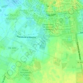
Name: humedales topographic map, elevation, terrain.
Average elevation: 690 m
Minimum elevation: 681 m
Maximum elevation: 700 m
Other topographic maps
Click on a map to view its topography, its elevation and its terrain.
Albacete
España > Castilla-La Mancha > Albacete
Albacete, Castilla-La Mancha, 02001, España
Average elevation: 717 m