Geolocate

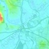
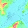
Laverton topographic map

Click on the map to display elevation.

About this map

Name: Laverton topographic map, elevation, terrain.

Location: Laverton, Tewkesbury, Gloucestershire, England, WR12 7NA, United Kingdom (51.99777 -1.91336 52.03777 -1.87336)

Average elevation: 122 m

Minimum elevation: 49 m

Maximum elevation: 304 m

Other topographic maps

Click on a map to view its topography, its elevation and its terrain.
Twyning

United Kingdom > England > Gloucestershire > Tewkesbury

Average elevation: 22 m

Hawling

United Kingdom > England > Gloucestershire > Tewkesbury

Average elevation: 241 m

Stanway

United Kingdom > England > Gloucestershire > Tewkesbury > Stanway

Average elevation: 170 m

Norton

United Kingdom > England > Gloucestershire > Tewkesbury

Average elevation: 18 m

Gretton

United Kingdom > England > Gloucestershire > Tewkesbury

Average elevation: 100 m

Snowshill

United Kingdom > England > Gloucestershire > Tewkesbury

Average elevation: 249 m

Northway

United Kingdom > England > Gloucestershire > Tewkesbury

Average elevation: 21 m

Twyning

United Kingdom > England > Gloucestershire > Tewkesbury

Average elevation: 22 m

Hasfield

United Kingdom > England > Gloucestershire > Tewkesbury

Average elevation: 21 m

Gear up for your next adventure:

🧼Clip-on Hand Sanitizer - Maintain hygiene when water for washing is scarce
👖Convertible Hiking Trousers - Zip-off legs to adapt to changing temperatures throughout the day
🎽Hiking Clothing - Breathable clothing for hiking
🪢Paracord - Multi-purpose survival cord
🧊Insulated Stainless Steel Flasks - Keep water cold for 24 hours in the heat or coffee hot in the cold

As an Amazon Associate, this site earns from qualifying purchases at no extra cost to you.