Geolocate

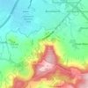
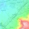
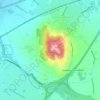
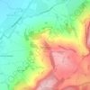
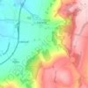
Snowshill topographic map

Click on the map to display elevation.

About this map

Name: Snowshill topographic map, elevation, terrain.

Location: Snowshill, Tewkesbury, Gloucestershire, England, United Kingdom (51.98736 -1.88020 52.01542 -1.80169)

Average elevation: 249 m

Minimum elevation: 91 m

Maximum elevation: 324 m

Other topographic maps

Click on a map to view its topography, its elevation and its terrain.
Hailes

United Kingdom > England > Gloucestershire > Tewkesbury

Average elevation: 134 m

Hasfield

United Kingdom > England > Gloucestershire > Tewkesbury

Average elevation: 27 m

Alstone

United Kingdom > England > Gloucestershire > Tewkesbury

Average elevation: 68 m

Laverton

United Kingdom > England > Gloucestershire > Tewkesbury

Average elevation: 122 m

Stanton

United Kingdom > England > Gloucestershire > Tewkesbury

Average elevation: 144 m

Langley

United Kingdom > England > Gloucestershire > Tewkesbury

Average elevation: 157 m

Chaceley

United Kingdom > England > Gloucestershire > Tewkesbury

Average elevation: 20 m

Haymes

United Kingdom > England > Gloucestershire > Tewkesbury > Southam

Average elevation: 147 m

Hailes

United Kingdom > England > Gloucestershire > Tewkesbury

Average elevation: 134 m

Gear up for your next adventure:

⌚Altimeter Barometer Watches - Outdoor watches with built-in sensors to track altitude changes and weather shifts
🛌Sleeping Mats - Insulated mats for camping comfort
👟Lightweight Trail Runners - Agile footwear for fast movement over rugged Australian terrain
🦟Heavy Duty Insect Repellent - Essential protection against flies, mozzies, and march flies
📟Satellite Messengers - Two-way satellite communication to stay in touch beyond the cellular grid

As an Amazon Associate, this site earns from qualifying purchases at no extra cost to you.