
Make a donation
Gear up for your next adventure:
As an Amazon Associate, this site earns from qualifying purchases at no extra cost to you.
New Ulm topographic map
Click on the map to display elevation.
Make a donation
Gear up for your next adventure:
As an Amazon Associate, this site earns from qualifying purchases at no extra cost to you.
About this map
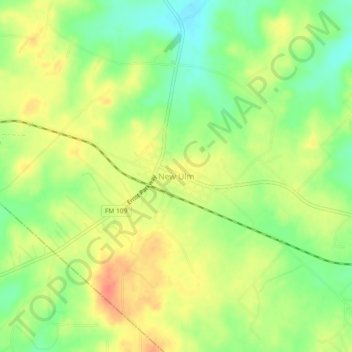
Name: New Ulm topographic map, elevation, terrain.
Location: New Ulm, Austin County, Texas, 78950, United States (29.87095 -96.50801 29.91095 -96.46801)
Average elevation: 118 m
Minimum elevation: 92 m
Maximum elevation: 141 m
Make a donation
Gear up for your next adventure:
As an Amazon Associate, this site earns from qualifying purchases at no extra cost to you.
Other topographic maps
Click on a map to view its topography, its elevation and its terrain.
Stephen F. Austin State Park
United States > Texas > Austin County > San Felipe
Average elevation: 41 m
Make a donation
Gear up for your next adventure:
As an Amazon Associate, this site earns from qualifying purchases at no extra cost to you.