
Castillo de San Juan Bautista topographic map
Interactive map
Click on the map to display elevation.
About this map
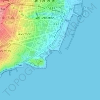
Name: Castillo de San Juan Bautista topographic map, elevation, terrain.
Average elevation: 19 m
Minimum elevation: -1 m
Maximum elevation: 111 m
Other topographic maps
Click on a map to view its topography, its elevation and its terrain.
Anaga
España > Santa Cruz de Tenerife
Anaga, Santa Cruz de Tenerife, Canarias, España
Average elevation: 210 m