
Philim topographic map
Interactive map
Click on the map to display elevation.
About this map
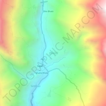
Name: Philim topographic map, elevation, terrain.
Location: Philim, Chum Nubri, गोरखा, Gandaki, Népal (28.37332 84.87662 28.41332 84.91662)
Average elevation: 2,044 m
Minimum elevation: 1,348 m
Maximum elevation: 3,153 m
Other topographic maps
Click on a map to view its topography, its elevation and its terrain.
Ārughāt Bāzār
Ārughāt Bāzār, Aarughat, गोरखा, Gandaki, Népal
Average elevation: 676 m