
Prok topographic map
Interactive map
Click on the map to display elevation.
About this map
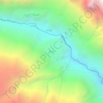
Name: Prok topographic map, elevation, terrain.
Location: Prok, Chum Nubri, गोरखा, Gandaki, Népal (28.50120 84.81384 28.54120 84.85384)
Average elevation: 2,780 m
Minimum elevation: 1,926 m
Maximum elevation: 4,269 m
Other topographic maps
Click on a map to view its topography, its elevation and its terrain.
Ārughāt Bāzār
Ārughāt Bāzār, Aarughat, गोरखा, Gandaki, Népal
Average elevation: 676 m