Geolocate

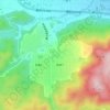
Kitakami topographic map

Click on the map to display elevation.

Kitakami

Kitakami is located in south-central Iwate Prefecture, in the Kitakami River valley, approximately 45 kilometers south of the prefectural capital of Morioka, and 490 kilometers north of Tokyo. The city is at the confluence of the Kitakami River and the Waga River and has an altitude ranging from 50 to 200 meters above sea level, rising to 400 meters in the east.

Wikipedia (CC-BY-SA 3.0)

About this map

Name: Kitakami topographic map, elevation, terrain.

Location: Kitakami, Iwate Prefecture, Japan (39.17442 140.81699 39.48123 141.25498)

Average elevation: 233 m

Minimum elevation: 31 m

Maximum elevation: 1,215 m

Other topographic maps

Click on a map to view its topography, its elevation and its terrain.
300M

Japan > Nagasaki

Average elevation: 220 m

Osaka Prefecture

Japan

Average elevation: 188 m

Takeda Castle

Japan > Asago

Average elevation: 174 m

Akaishi Mountains

Japan > Oshika

Average elevation: 2,591 m

Iwo to

Japan > Tokyo > Ogasawara

Average elevation: 0 m

葭町

Japan > Matsumoto

Average elevation: 616 m

Nishikigaoka-chuo Park

Japan > Sendai

Average elevation: 197 m

Nakauonuma County

Japan

Average elevation: 605 m

Mount Yatsugatake viewpoint

Japan > Suwa County > Fujimi

Average elevation: 1,742 m

Gear up for your next adventure:

🧊Insulated Stainless Steel Flasks - Keep water cold for 24 hours in the heat or coffee hot in the cold
⌚Altimeter Watches - Watches with altitude tracking
🏃Compression Recovery Socks - Reduce leg fatigue after heavy days of elevation gain
📷Backpack Camera Clips - Quick access to your camera while keeping your hands free for climbing
🦘Outback Survival Gear - Essential gear for Australian outback

As an Amazon Associate, this site earns from qualifying purchases at no extra cost to you.