
Dong-gu topographic map
Interactive map
Click on the map to display elevation.
About this map
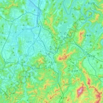
Name: Dong-gu topographic map, elevation, terrain.
Location: Dong-gu, Daejeon, South Korea (36.19407 127.41324 36.44124 127.55962)
Average elevation: 165 m
Minimum elevation: 23 m
Maximum elevation: 877 m