
Al Wahat topographic map
Interactive map
Click on the map to display elevation.
About this map
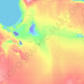
Name: Al Wahat topographic map, elevation, terrain.
Location: Al Wahat, Libye (27.00767 18.49929 31.41107 25.00250)
Average elevation: 126 m
Minimum elevation: -48 m
Maximum elevation: 518 m
Other topographic maps
Click on a map to view its topography, its elevation and its terrain.
Marsa Al Burayqah
Libye > Al Wahat > مدينه البريقه وضواحيها
Marsa Al Burayqah, مدينه البريقه وضواحيها, Al Wahat, Libye
Average elevation: 12 m