
Zigoti topographic map
Interactive map
Click on the map to display elevation.
About this map
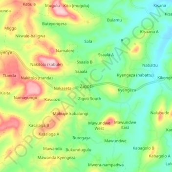
Name: Zigoti topographic map, elevation, terrain.
Location: Zigoti, Mityana, Central Region, Uganda (0.33905 32.12573 0.41905 32.20573)
Average elevation: 1,215 m
Minimum elevation: 1,131 m
Maximum elevation: 1,354 m
Other topographic maps
Click on a map to view its topography, its elevation and its terrain.