Geolocate

Onemo topographic map

Click on the map to display elevation.

About this map

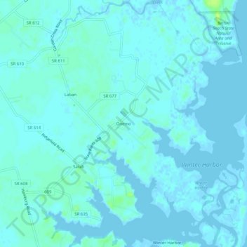
Name: Onemo topographic map, elevation, terrain.

Location: Onemo, Mathews County, Virginia, 23130, United States (37.37569 -76.29272 37.41569 -76.25272)

Average elevation: 2 m

Minimum elevation: -5 m

Maximum elevation: 13 m

Other topographic maps

Click on a map to view its topography, its elevation and its terrain.

Gear up for your next adventure:

🧼Biodegradable Soap - Eco-friendly outdoor soap
📦Crushproof Equipment Cases - Safe transport for sensitive surveying and mapping instruments
🦟Heavy Duty Insect Repellent - Essential protection against flies, mozzies, and march flies
📱Shockproof Phone Cases - Extra protection for your smartphone against drops on rocky terrain
🛠️Outdoor Repair Kits - Gear repair kits

As an Amazon Associate, this site earns from qualifying purchases at no extra cost to you.