Geolocate

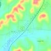
Goodspring topographic map

Click on the map to display elevation.

About this map
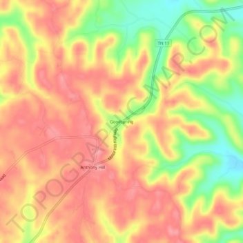
Name: Goodspring topographic map, elevation, terrain.

Location: Goodspring, Giles County, Middle Tennessee, Tennessee, 38460, United States (35.12341 -87.12140 35.16341 -87.08140)

Average elevation: 280 m

Minimum elevation: 214 m

Maximum elevation: 318 m

Other topographic maps

Click on a map to view its topography, its elevation and its terrain.
Minor Hill

United States > Tennessee > Giles County

Average elevation: 243 m

Lynnville

United States > Tennessee > Giles County

Average elevation: 246 m

Pulaski

United States > Tennessee > Giles County

Average elevation: 233 m

Ardmore

United States > Tennessee > Giles County

Average elevation: 253 m

Elkton

United States > Tennessee > Giles County

Average elevation: 209 m

Gear up for your next adventure:

🏃Compression Recovery Socks - Reduce leg fatigue after heavy days of elevation gain
🛌Compact Down Sleeping Bags - Warmth without the bulk, ideal for backcountry camping
🧥Insulated Down Jackets - High warmth-to-weight ratio for cold nights in the high country
🦟Insect Repellent - Protection against insects
💡Collapsible Camping Lanterns - Illuminate your base camp or tent for map studying at night

As an Amazon Associate, this site earns from qualifying purchases at no extra cost to you.