
Betalghat topographic map
Interactive map
Click on the map to display elevation.
About this map
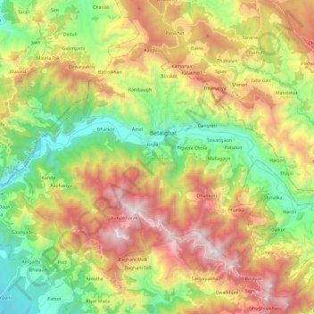
Name: Betalghat topographic map, elevation, terrain.
Location: Betalghat, Nainital District, Uttarakhand, 263134, India (29.46576 79.23153 29.61413 79.46588)
Average elevation: 1,446 m
Minimum elevation: 595 m
Maximum elevation: 2,588 m
Other topographic maps
Click on a map to view its topography, its elevation and its terrain.