Geolocate

Gloppen topographic map

Click on the map to display elevation.

About this map

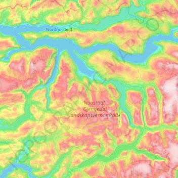
Name: Gloppen topographic map, elevation, terrain.

Location: Gloppen, Vestland, Norway (61.58596 5.63659 61.86928 6.75811)

Average elevation: 606 m

Minimum elevation: -1 m

Maximum elevation: 1,808 m

Other topographic maps

Click on a map to view its topography, its elevation and its terrain.

Kaupanger

Norway > Vestland

Average elevation: 249 m

Røldal

Norway > Vestland

Average elevation: 738 m

Loen

Norway > Vestland

Average elevation: 381 m

Meland

Norway > Vestland

Average elevation: 185 m

Frekhaug

Norway > Vestland

Average elevation: 44 m

Myrkdalen

Norway > Vestland

Average elevation: 575 m

Osterøy

Norway > Vestland

Average elevation: 262 m

Vikaneset

Norway > Vestland

Average elevation: 129 m

Lofthus

Norway > Vestland

Average elevation: 247 m

Florø

Norway > Vestland > Florø

Average elevation: 13 m

Sognefjorden

Norway > Vestland

Average elevation: 0 m

Gear up for your next adventure:

🧭Military Style Lensatic Compass - Durable sighting compasses for advanced land navigation and surveying
📷Backpack Camera Clips - Quick access to your camera while keeping your hands free for climbing
🔪Multitools - Compact tools for outdoor use
🔪Outdoor Multi-tools - Versatile tools for gear repair and survival tasks in the wilderness
🕯️Emergency Whistles - Safety whistles for hiking

As an Amazon Associate, this site earns from qualifying purchases at no extra cost to you.