
Zimbor topographic map
Interactive map
Click on the map to display elevation.
About this map
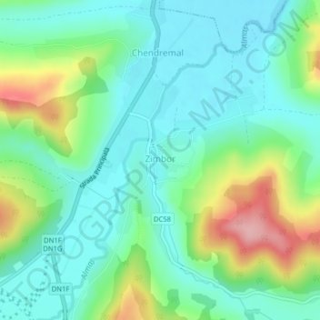
Name: Zimbor topographic map, elevation, terrain.
Location: Zimbor, Sălaj, 457370, Romania (46.99367 23.25229 47.01100 23.27404)
Average elevation: 300 m
Minimum elevation: 259 m
Maximum elevation: 401 m
Other topographic maps
Click on a map to view its topography, its elevation and its terrain.