
Meringandan topographic map
Interactive map
Click on the map to display elevation.
About this map
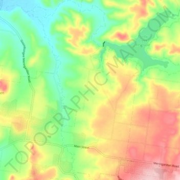
Name: Meringandan topographic map, elevation, terrain.
Location: Meringandan, Toowoomba Regional, Queensland, Australia (-27.44117 151.88780 -27.36407 151.94187)
Average elevation: 518 m
Minimum elevation: 436 m
Maximum elevation: 623 m
Other topographic maps
Click on a map to view its topography, its elevation and its terrain.
Meringandan
Australia > Queensland > Meringandan
Meringandan West, Meringandan, Toowoomba Regional, Queensland, Australia
Average elevation: 509 m