
Lyngdal topographic map
Interactive map
Click on the map to display elevation.
About this map
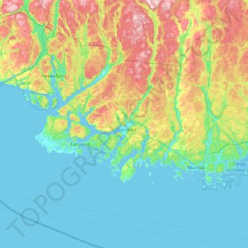
Name: Lyngdal topographic map, elevation, terrain.
Location: Lyngdal, Agder, Norwegen (57.78775 6.77248 58.51561 7.53249)
Average elevation: 151 m
Minimum elevation: -1 m
Maximum elevation: 712 m
Other topographic maps
Click on a map to view its topography, its elevation and its terrain.