Geolocate

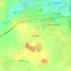
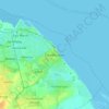
Brigsley topographic map

Click on the map to display elevation.

About this map

Name: Brigsley topographic map, elevation, terrain.

Location: Brigsley, North East Lincolnshire, Greater Lincolnshire, England, United Kingdom (53.48775 -0.12682 53.50905 -0.07334)

Average elevation: 23 m

Minimum elevation: 8 m

Maximum elevation: 70 m

Other topographic maps

Click on a map to view its topography, its elevation and its terrain.
Gear up for your next adventure:

⛺Lightweight Tents - Compact tents for backpacking
📸Action Cameras - Record your journey across interesting topographic features in 4K
🚴Cycling Backpacks - Backpacks for cyclists
🏫Topographic World Globes - 3D physical relief globes to understand global geography
👟Lightweight Trail Runners - Agile footwear for fast movement over rugged Australian terrain

As an Amazon Associate, this site earns from qualifying purchases at no extra cost to you.