
Atia topographic map
Interactive map
Click on the map to display elevation.
About this map
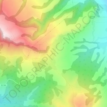
Name: Atia topographic map, elevation, terrain.
Location: Atia, Corund, Harghita, 537061, Romania (46.46677 25.10963 46.50677 25.14963)
Average elevation: 715 m
Minimum elevation: 514 m
Maximum elevation: 977 m
Other topographic maps
Click on a map to view its topography, its elevation and its terrain.
Carpathian Mountains
Carpathian Mountains, Toplița, Harghita, 535705, Romania
Average elevation: 980 m
Miercurea Ciuc
Romania > Harghita > Miercurea Ciuc
Miercurea Ciuc, Harghita, Romania
Average elevation: 689 m