
Kalumunda Forest Reserve topographic map
Interactive map
Click on the map to display elevation.
About this map
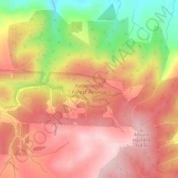
Name: Kalumunda Forest Reserve topographic map, elevation, terrain.
Average elevation: 265 m
Minimum elevation: 101 m
Maximum elevation: 364 m
The District Council of Yankalilla trails, hiking, mountain biking, running and outdoor activities
Other topographic maps
Click on a map to view its topography, its elevation and its terrain.
Inman Valley
Australia > South Australia > The District Council of Yankalilla
In the valley is Selwyn Rock (35°29′47″S 138°30′45″E / 35.4965°S 138.5124°E / -35.4965; 138.5124) a glaciated pavement in the bed of the Inman River. It was first described in 1859 by, and later named for, A.R.C. Selwyn, who was Victorian Government geologist at the time. Glacial grooves…
Average elevation: 212 m
Deep Creek National Park
Australia > South Australia > The District Council of Yankalilla
Average elevation: 183 m
Myponga Beach
Australia > South Australia > The District Council of Yankalilla
Average elevation: 110 m
Inman Valley
Australia > South Australia > The District Council of Yankalilla
In the valley is Selwyn Rock (35°29′47″S 138°30′45″E / 35.4965°S 138.5124°E / -35.4965; 138.5124) a glaciated pavement in the bed of the Inman River. It was first described in 1859 by, and later named for, A.R.C. Selwyn,[17] who was Victorian Government geologist at the time. Glacial…
Average elevation: 212 m
Second Valley
Australia > South Australia > The District Council of Yankalilla
Average elevation: 173 m
Carrickalinga
Australia > South Australia > The District Council of Yankalilla
Average elevation: 53 m