
Second Valley topographic map
Interactive map
Click on the map to display elevation.
About this map
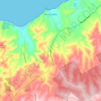
Name: Second Valley topographic map, elevation, terrain.
Average elevation: 173 m
Minimum elevation: -1 m
Maximum elevation: 348 m
The District Council of Yankalilla trails, hiking, mountain biking, running and outdoor activities
Other topographic maps
Click on a map to view its topography, its elevation and its terrain.
Kalumunda Forest Reserve
Australia > South Australia > The District Council of Yankalilla
Average elevation: 265 m
Myponga River
Australia > South Australia > The District Council of Yankalilla > Myponga > Myponga Beach
Average elevation: 138 m