
Samuel topographic map
Interactive map
Click on the map to display elevation.
About this map
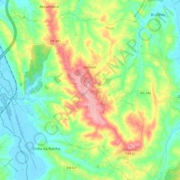
Name: Samuel topographic map, elevation, terrain.
Location: Samuel, Soure, Coímbra, Portugal (40.05079 -8.76391 40.12188 -8.67668)
Average elevation: 50 m
Minimum elevation: -2 m
Maximum elevation: 141 m
Other topographic maps
Click on a map to view its topography, its elevation and its terrain.